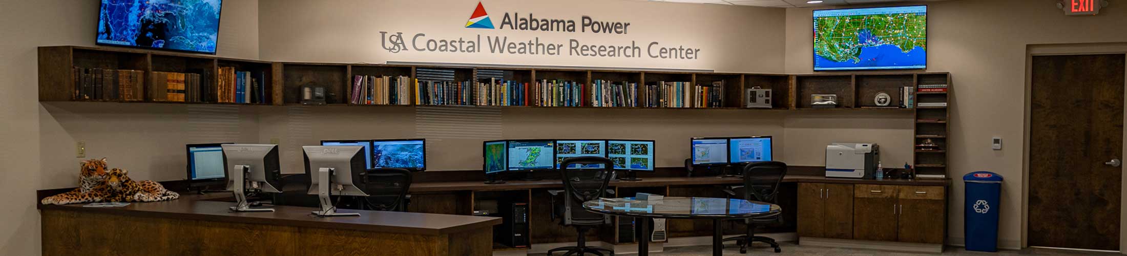
Although the 1997 hurricane season
was one of the weakest on record, the Mobile area experienced
its most unusual tropical cyclone. Most of the hurricanes
that have caused significant damage in Mobile developed
over the Atlantic, Caribbean, or the southern Gulf of
Mexico. These storms were usually tracked for many days
before reaching the Gulf Coast with considerable strength
and forward motion. However, Hurricane Danny was quite
different. Rather than forming in the deep tropics, Danny
developed near the Gulf Coast from a non-tropical system.
Furthermore, as the storm approached the coast, it slowed
to a crawl. Then, after making landfall, it stalled for
hours over Mobile Bay followed by a slow, meandering departure.
Danny actually formed from an upper air disturbance
that drifted southward from the Great Lakes to the Gulf
of Mexico in mid July. A large area of thunderstorms
then formed south of Louisiana gradually assuming tropical
characteristics. On the 17th of July, the system intensified
and became Tropical Storm Danny.
Tracking northeastward toward southeast Louisiana,
Danny strengthened to a minimal hurricane on the 18th
just before crossing the Mississippi River southeast
of New Orleans. A wind gust of 95 mph was recorded at
Grand Isle, Louisiana where considerable damage occurred
to marine facilities.
Following a slow, erratic path across the Chandeleur
Islands, Danny turned northward reaching the Fort Morgan
Peninsula on the 19th. Danny entered Mobile Bay where
it stalled and, in an unusual move, achieved its lowest
barometric pressure. Although the storm was small, it
packed strong wind gusts that reached 80 mph over the
Fort Morgan Peninsula, Bon Secour Bay, and Dauphin Island.
In fact, a gust of 101 mph was recorded at the Dauphin
Island Sea Lab. Wind gusts of 70-75 mph were felt over
Gulf Shores, Mullet Point, and the western shore of
Mobile Bay south of Dog River.
With Hurricane Danny in the Alabama coastal waters
on the night of Friday July 18, 1997 there was a sizeable
difference in forecast paths between the "Official"
National Hurricane Center and the Coastal Weather Research
Center. Hurricane Danny actually moved into Mobile Bay
8 hours later. You may see an example of the Blackwell
Over-surface Hurricane Wind (BLOHW) Model as it demonstrates
the two different forecast
paths.
The
Sands at Romar Beach condominium suffered wind
damage from Hurricane Danny.
Hurricane force winds and
high tides forced this fishing boat into a Dauphin
Island yard.
Photo
by G.M. Andrews - Mobile Register
Rainfall totals of 25"-30"
caused severe flooding along the Fowl River in
south Mobile County.
Photo
by Kiichiro Sato - Mobile Register
Danny's legacy was
rain, not wind. Once the storm stalled over Mobile Bay,
the storm's circular configuration changed radically resulting
in the creation of an enormous rain "pocket"
on the western side of the system. This area of torrential
rain remained nearly stationary for seven to nine hours
resulting in incredible rainfall totals over Dauphin Island
and southeast Mobile County. The Dauphin Island Sea Lab
recorded 36.71" of rain for the storm with 25.98"
in seven hours. Doppler
radar in Mobile estimated more than 43" over southwest
Mobile Bay!
Heavy rains on the eastern
shore of Mobile Bay caused severe erosion to this
property in Daphne.
Photo
by Mary Hattler - Mobile Register
During the evening of July 19th, Danny's
eye moved into Baldwin County around Weeks Bay. This resulted
in an eastward shift of the major rainfall center. Torrential
rains pounded western Baldwin County through the night
and into the morning of July 20th. Rainfall totals of
20"-25" fell over Baldwin County causing record
flooding on the Fish River with considerable damage to
homes, bridges, and roads across the county.
On July 19, while Hurricane
Danny was producing torrential rains over Mobile
County, near hurricane force winds were pushing
Mobile Bay waters away from the Montrose shoreline.
Photo
by Jonathan B. Newman
After flooding the coastal counties,
Danny was not through! The storm drifted northwest reaching
Choctaw County late on the 20th where it dumped 12"-15"
of rain causing severe flooding. Additional heavy rains
spread northward through western Alabama as Danny drifted
inland. Amazingly, Danny maintained its circulation across
northern Alabama, northern Georgia and the Carolinas and
then strengthened again as it entered the western Atlantic.
Gale force winds were recorded along the Virginia coast
and as far north as Nantucket Island, Massachusetts.
University
of South Alabama - Mobile
Alabama 36688-0002 / 1 (251) 460-6101
For questions or comments Contact
Us
Last date changed:
September 19, 2005 3:30 PM
http://www.southalabama.edu/cwrc/ahdanny.html