Archaeology in Action: Excavating a Hurricane
Posted on May 5, 2023 by Center for Archaeological Studies
Hurricanes are the most common natural disaster to affect the Gulf Coast; in fact, since 1850, the Mobile Bay area has been impacted by 37 hurricanes. When we began excavations for the I-10 Mobile River Bridge (MRB) Archaeology Project, we were surprised to find hurricanes leave behind evidence in the archaeological record (below). Their presence is twofold – while we can study how hurricanes impacted people in the past, we are also aware of how hurricanes affect cultural resources in the present.
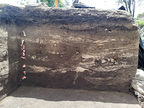 Storm deposits excavated for the I-10 MRB Archaeology Project. Deposits of white sand
are mixed with the darker soils, leaving a “swirly” or “wavy” appearance.
Storm deposits excavated for the I-10 MRB Archaeology Project. Deposits of white sand
are mixed with the darker soils, leaving a “swirly” or “wavy” appearance.
One of the biggest impacts from a hurricane is storm surge (below). A storm surge occurs when the strong winds and waves of a hurricane force water onto the shore. This influx of water is a result of a drastic change in sea level. Along with an excess of water, storm surges also carry sediments and other materials inland. As sediments and materials are redeposited, they form new layers or strata. Storm surges cause flooding and structural damage, both of which leave traces in the archaeological record.
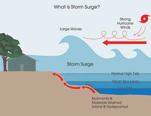
Storm surge activity. Graphic created by Amy Vega.
We’ve excavated storm deposits at several archaeological sites as part of the I-10 MRB Archaeology Project (below). Storm deposits allow us to study how past Mobilians adapted and responded to natural disasters. These responses are influenced by factors such as class and race, which often determine access to resources. We can learn lessons from our past successes and failures with hurricanes, particularly as they become more common due to climate change. We explored the impact of past hurricanes in our virtual exhibit, “Weathering the Storm: The Archaeology of Mobile Bay Hurricanes.”
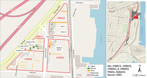 Left: Locations where storm surges have been identified at four archaeological sites
along South Water Street. Right: The I-10 MRB Archaeology Project area. The four sites
on the left are red in this map, while the other sites for the I-10 project are in
gray.
Left: Locations where storm surges have been identified at four archaeological sites
along South Water Street. Right: The I-10 MRB Archaeology Project area. The four sites
on the left are red in this map, while the other sites for the I-10 project are in
gray.
This information was presented by Jenni L. Baggett and C. Kirk at the 2022 Southeastern Archaeological Conference in Little Rock, Arkansas. Check out their poster or check out other posters here.