Archaeology in Action: The Eslava Street Site
Posted on July 26, 2023 by Rachel Hines
We excavated the Eslava Street Site, also known as 1MB531, in 2021-2022 as part of the I-10 Mobile River Bridge Archaeology Project. This site is located right on Mobile Bay between Eslava and Madison Streets. This is the youngest site in our project area because it’s the closet to the water; the site is on built land that didn’t exist prior to the 19th century.
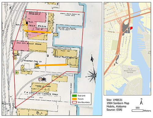 1904 Sanborn Fire Insurance Map showing our 2021-2022 excavations at the Eslava Street
Site. Map courtesy of the Library of Congress.
1904 Sanborn Fire Insurance Map showing our 2021-2022 excavations at the Eslava Street
Site. Map courtesy of the Library of Congress.
In the mid-1830s, the land east of Water Street was constructed to create the Eslava Street Site. This area was primarily used for warehouses and shipyards due to proximity to the water. The commercial industries peaked in the early 20th century and started declining by the 1950s. Though we didn’t recover many artifacts at this site, we did learn about the filling episodes there. The top 1.5-2 meters of fill includes brick rubble, creosote, burnt asphalt shingles, sawdust, industrial waste, and other debris. Earlier layers of fill extended below the water table, which we weren’t able to investigate.
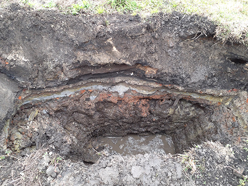 Test unit at the Eslava Street Site showing layers of deposition.
Dr. Alex Beebe of the University of South Alabama Department of Earth Sciences created a 3d model of a test unit that shows the many layers of fill at the site, including a large timber and brick rubble. He also created a model of our excavations in progress.
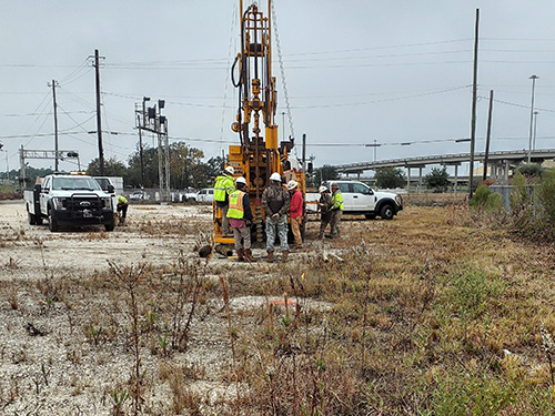 ALDOT conducts deep test coring to determine the soil depth and stratigraphy at this site.
Due to the extensive fill, the water table, and disturbances from industrial activities, we conducted limited archaeological testing at this site. As we continue our analyses, we hope this site will tell us more about how the waterfront was constructed. We may be able to discern how this landscape change impacts the effects from hurricanes and storms.
This site was one of fifteen sites excavated for the I-10 project. Follow along as we continue to feature our work!