Archaeology in Action: Maryland Street Site
Posted on January 30, 2024 by Rachel Hines
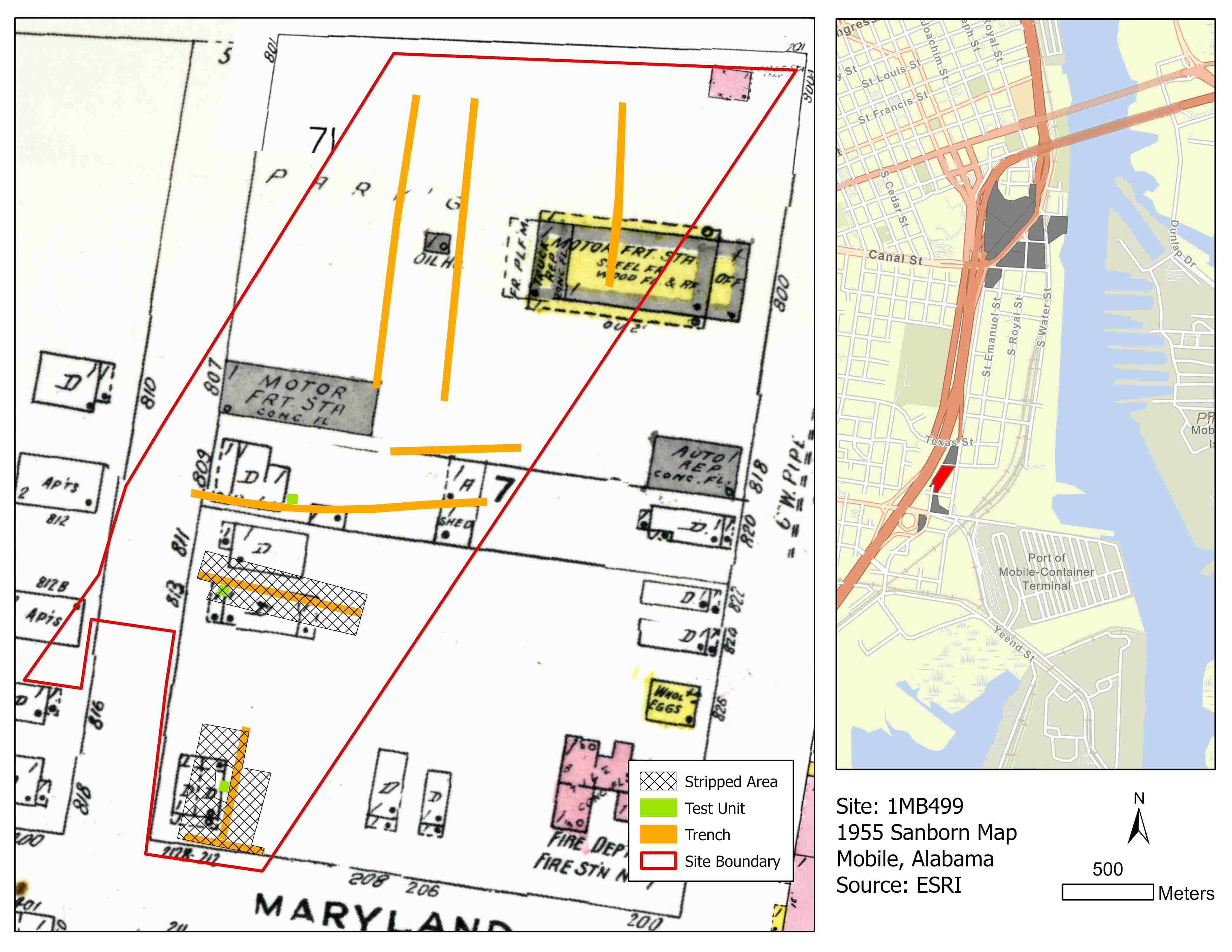
We excavated the Maryland Street Site, also known as 1MB499, in 2022 for the I-10 Mobile River Bridge Archaeology Project. This site is bound by I-10, New Jersey, South Conception, and, of course, Maryland Street. This area wasn’t shown on most historic maps and doesn’t appear to have grown until the mid-1900s. The 1955 Sanborn Fire Insurance map (below) shows eight dwellings, an auto repair shop, a fire station, and other commercial buildings.
 2022 excavations at the Maryland Street Site on the 1955 Sanborn Fire Insurance Map
(left). Courtesy of the Library of Congress. The map on the right shows the location
of the site (in red) and the other sites for the I-10 MRB Archaeology Project (in
gray).
Though there’s only one structure shown on the block on the 1924 Sanborn Fire Insurance Map, at that time, Mobile’s population was booming; it nearly doubled between 1940-1943 due to growth during WWII. Many people moved Down the Bay to be near major workplaces, like ADDSCO and Brookley Field. Because of this, lots of housing was built in the neighborhood. Liam Hodges explored the topic in a blog post.
Two houses on the block, 811 and 813 S. Franklin Street, were part of that trend. Sterling and Ella May McCall purchased the lot at 811 South Franklin Street in 1949 and lived there with their children, Wilford and Sterling Jr., into the 1960s. Sterling’s sister-in-law, Maggie Sanders, moved in next door at 813 S. Franklin Street in 1952 and lived there into the 1970s. The McCall and Sanders families were working-class African Americans; Sterling worked at the shipyards, while Maggie was a maid at the Battle House Hotel. Their homes survived the construction of I-10, but the interstate was built right in their backyards. Both families owned their homes though and were likely hesitant to sell them.
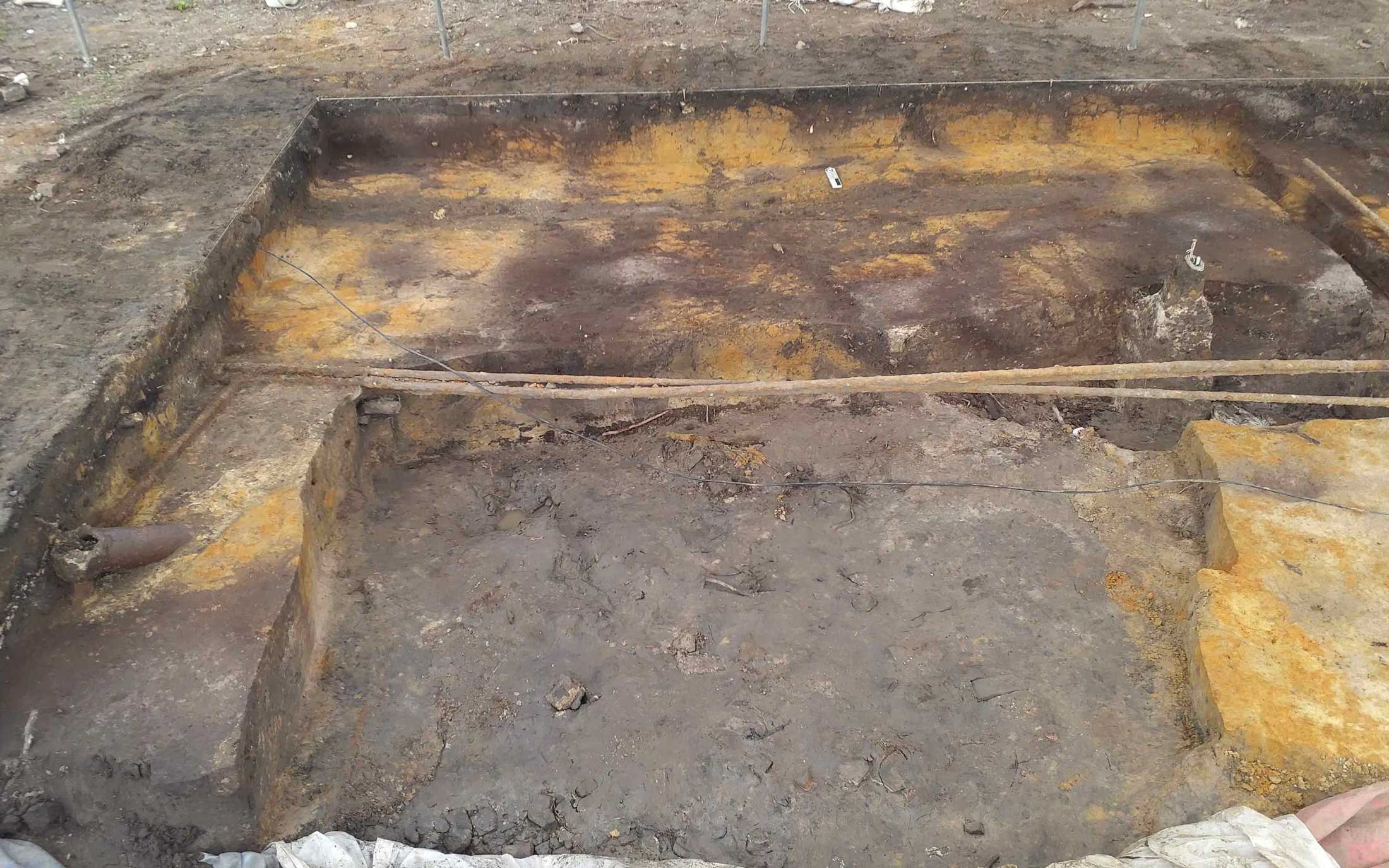
 Utility lines cross and pipes cross a unit at the Maryland Street Site. When utility
lines are put in, they disturb or even completely destroy any remaining archaeological
deposits in the area.
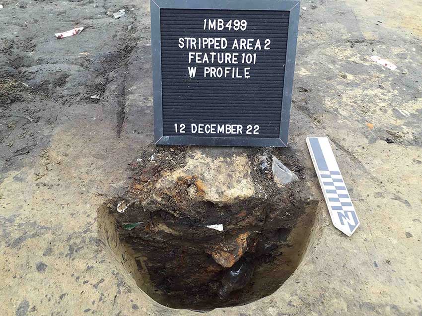
The northern part of the site was heavily disturbed, so our work focused on the south part of the site. This area had pavement and industrial buildings before we began our work, so we weren’t sure if there would be any preserved deposits beneath them. Robert Tools lived north of the McCall Family at 809 S. Franklin Street, where he operated R.L. Tools Plumbing and Heating, but we didn’t find many intact deposits near his home. In the south part of the site, there was a duplex at 212 Maryland Street, which was heavily disturbed by utility lines (above). The northern part of the site, which was mostly home to an auto repair shop, was also disturbed. The area around the McCall and Sanders homes had the most intact archaeological deposits at the Maryland Street Site. We found archaeological remains, including several trash pits (below), in their side yards and backyards, as well as under the former house structures.
 A trash pit excavated between the McCall and Sanders homes on South Franklin Street.
As we analyze the artifacts found at the site, we hope to learn more about the development of Down the Bay, especially during such a formative period of growth in Mobile. The Maryland Street Site is one of 15 sites we excavated for the I-10 Mobile River Bridge Archaeology Project. Stay tuned to learn more about our excavations and what we’ve learned so far!
