Archaeology in Action: Williams Inspection Site
Posted on March 4, 2024 by Rachel Hines
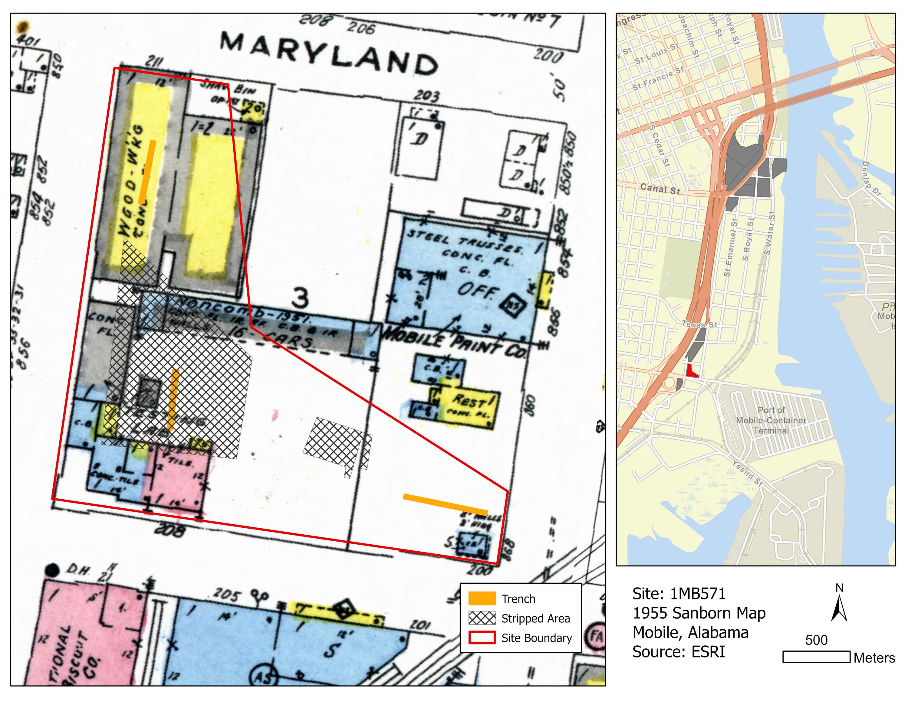
We excavated the Williams Inspection Site, or 1MB571, for the I-10 Mobile River Bridge Archaeology Project in 2022. The site is bound by Maryland, South Conception, Virginia, and South Franklin Streets and it is named for the Williams Inspection Company, which was located at the southwest corner of the site.
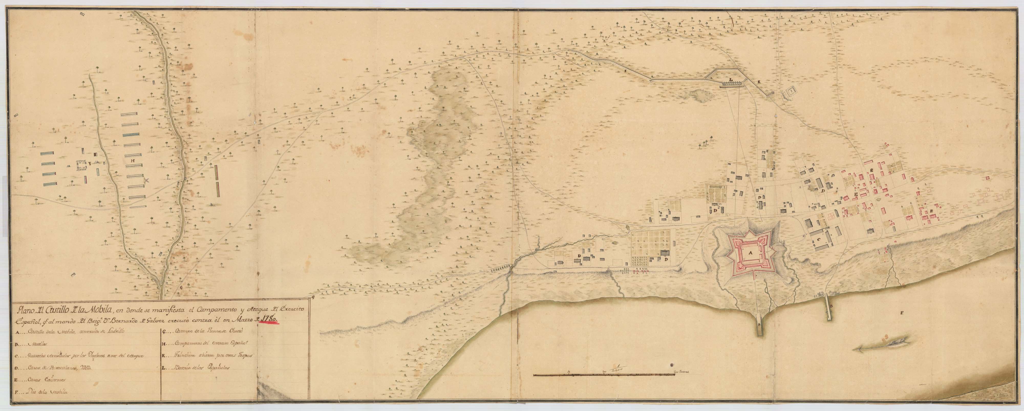
We investigated the Williams Inspection Site because it had potential for Native American and colonial components, like at the Virginia Street Site across the street, and because the presence of buildings and a parking lot prevented testing before our excavation. We were also curious if we’d find evidence from a colonial Spanish army encampment in this area based on the ca. 1780 “Galvez” map.
 1955 Sanborn Fire Insurance Map showing our 2022 excavations at the Williams Inspection
Site. Map courtesy of the Library of Congress.
This map (below) illustrates the Spanish siege of British Mobile in 1870 led by the Governor of Spanish Louisiana Don Bernardo de Galvez. The map depicts the Spanish encampments, batteries, and travel routes on the landscape surrounding Mobile. Though the map shows Choctaw Point and several drainages, it is difficult to align to our modern map due to landscape change and a lack of identifiable features. Unfortunately, while a Spanish encampment may have been located near the Williams Inspection site, we didn’t identify any evidence of it during our excavations.
 1780 Galvez Map of Mobile, Courtesy Archivo General Militar de Madrid.
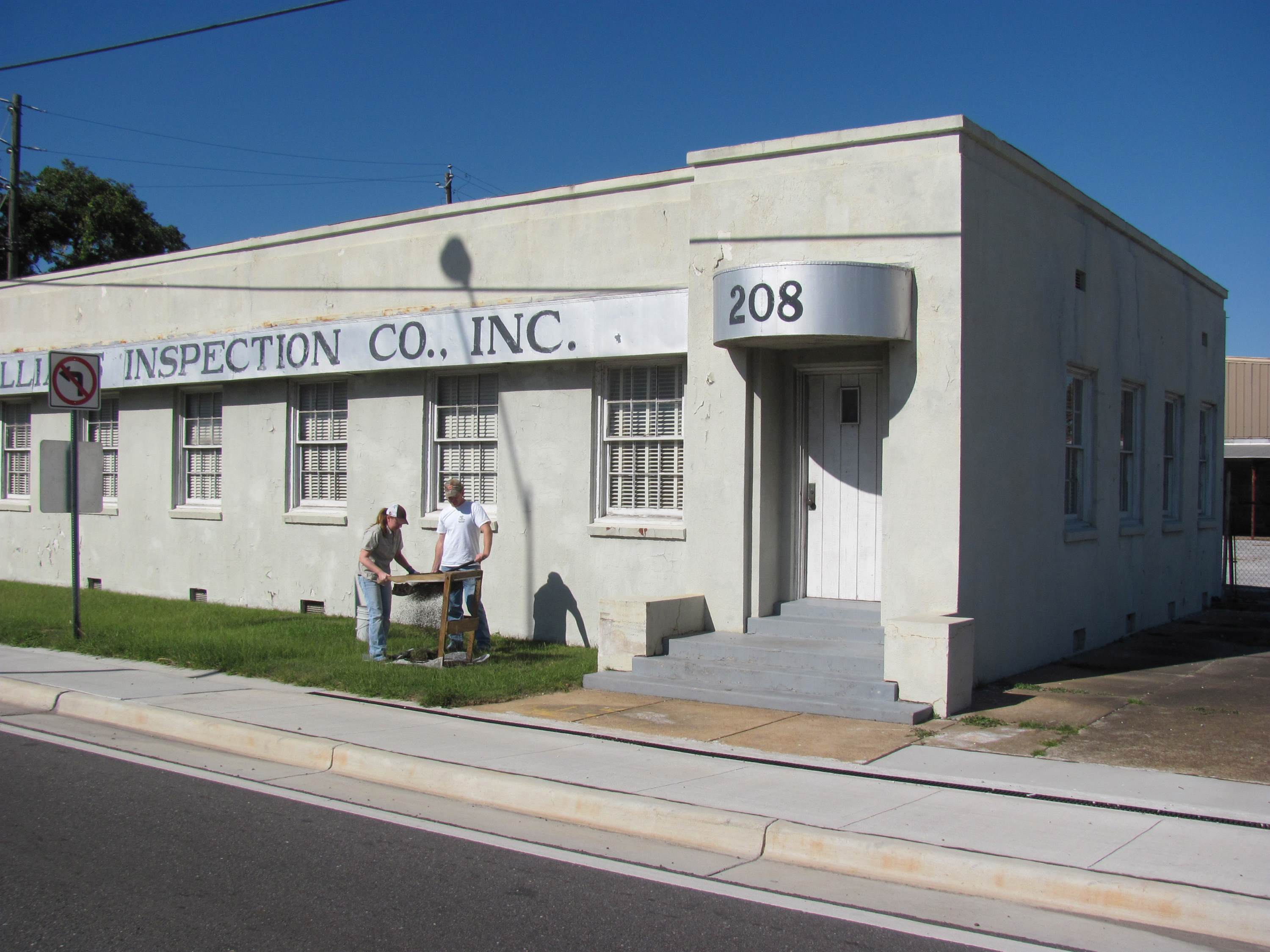
In fact, we didn’t find much evidence of anything at this site! Our excavations revealed this site has been heavily disturbed by construction. Though we recovered a handful of artifacts, most dated to the mid-20th century or later and were construction materials, like glass fragments, nails, brick, and oyster shell. This site first appears in maps around the 1920s, when several houses were built in the northeast corner of the block. By 1955, the site grew to include the Williams Inspection Company (shown in the image below) in the southwest corner, a woodworking shop in the northwest corner, Mobile Paint Company to the east, and a restaurant and corner store in the southeast corner.

Archaeologists shovel testing at the Williams Inspection Site in 2010. The building has since been demolished as part of the I-10 Bridge widening project.
Due to the disturbance and lack of archaeological material, we conducted limited excavations at this site and wrapped up quickly to focus on more productive sites. This is one of 15 sites that we excavated for the I-10 Mobile River Bridge Archaeology Project. Follow along to learn more about our excavations and what we’ve uncovered so far!
